Atlas of Bangladesh
67 maps of Bangladesh, at two geographies: 64 districts and 544 upazilas. Every plate states its finding in the headline and carries its own source and any caveat on the figure itself, so a plate can be read, and checked, on its own.
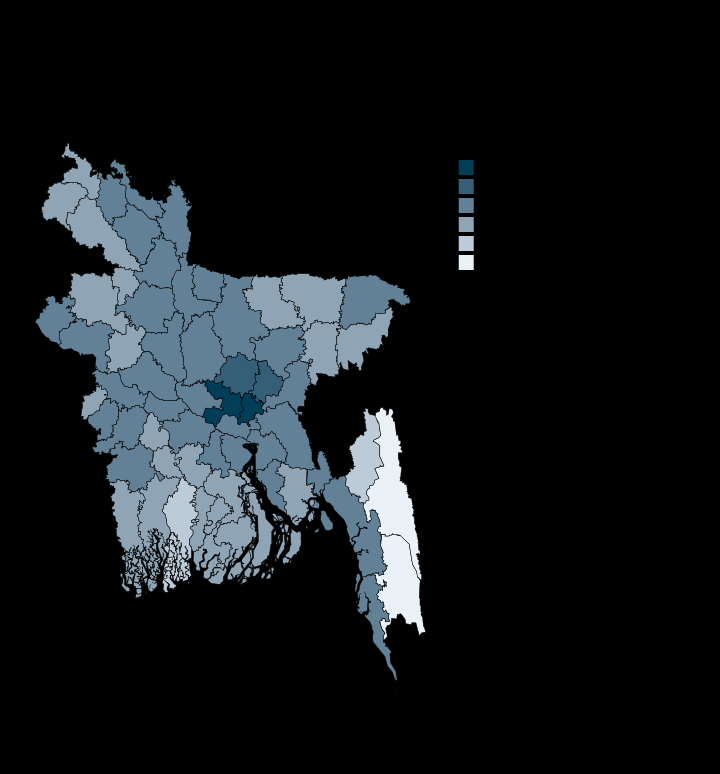
Dhaka packs 95 times more people per square kilometre than Rangamati
Rangamati 106.0 · Dhaka 10067.0 · Persons per km2
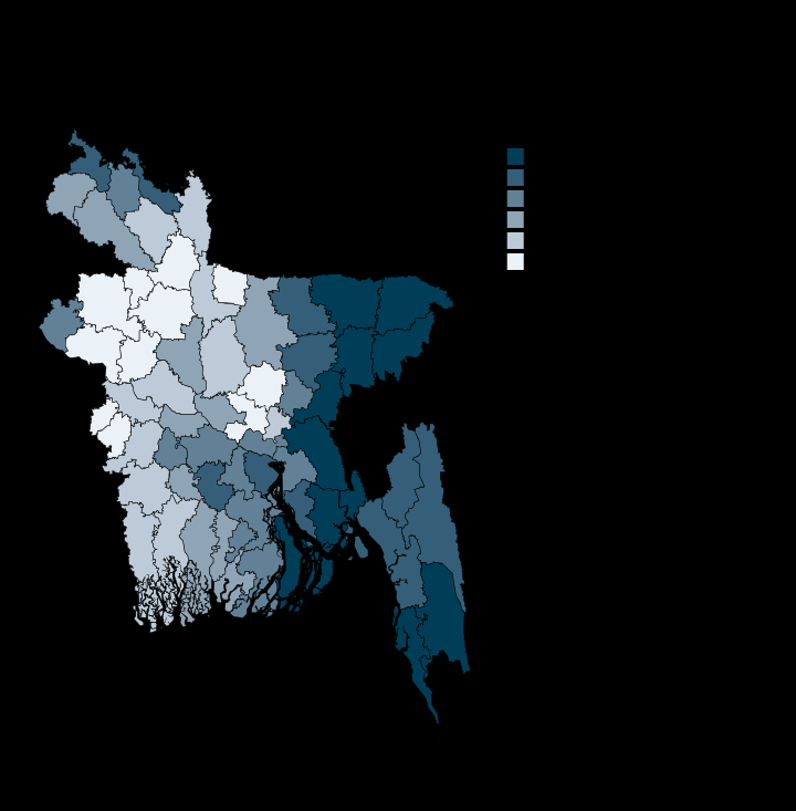
Sylhet's households hold 5.2 people, Gazipur's 3.3
Gazipur 3.33 · Sylhet 5.17 · Persons per household
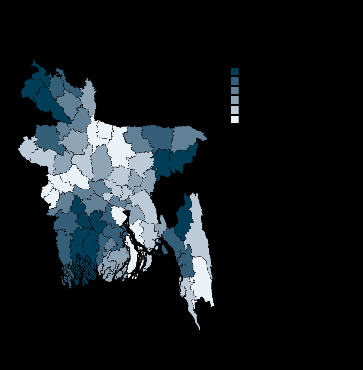
Gopalganj is 27% Hindu, Meherpur 1%
Meherpur 1.2 · Gopalganj 26.9 · Per cent of population
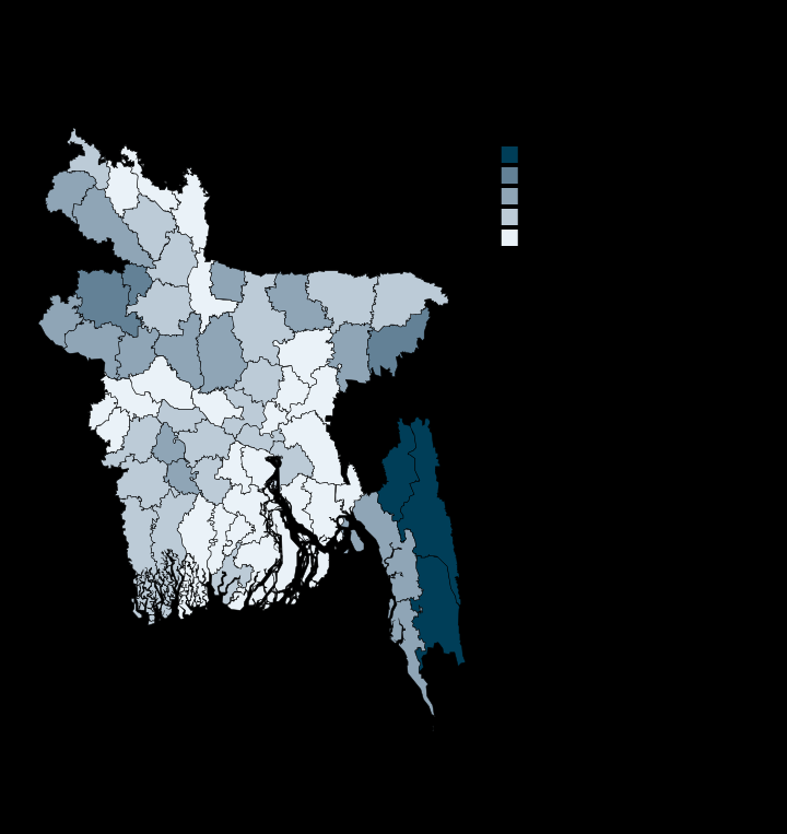
Ethnic minorities are 1% of Bangladesh and 58% of Rangamati
Kurigram 0.0 · Rangamati 57.6 · Per cent of population
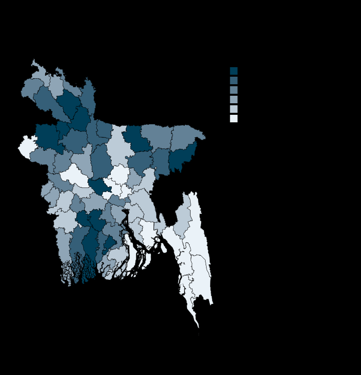
One woman in ten aged 10 and over is widowed
Gazipur 6.6 · Netrakona 11.8 · Per cent of women 10+
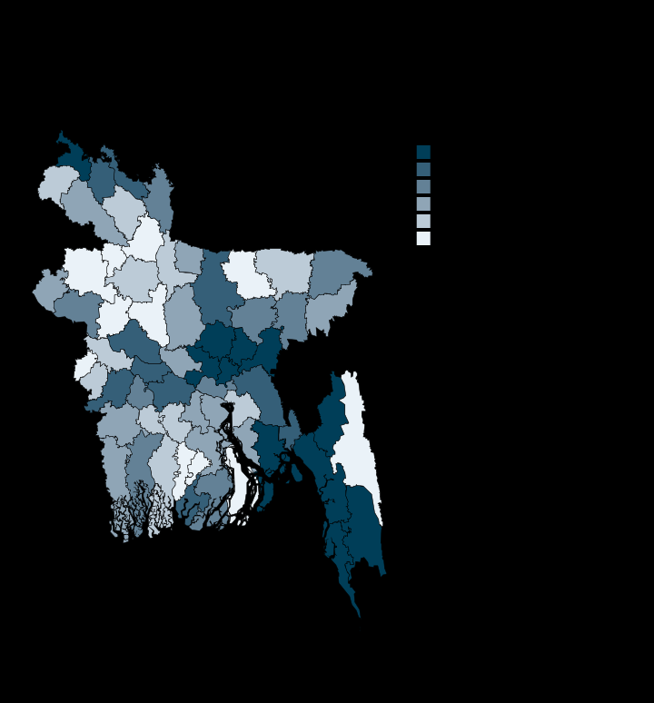
Gazipur grew three times faster than the country; only Jhalokati shrank
Jhalokati -0.28 · Gazipur 3.87 · Per cent a year
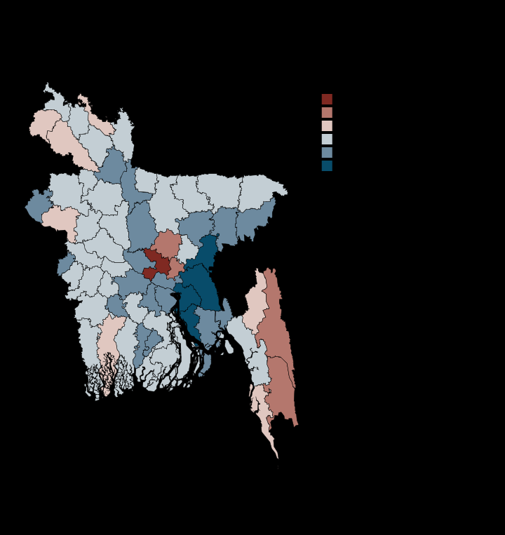
Brahmanbaria has 87 men per 100 women, Dhaka has 116
Brahmanbaria 87.0 · Dhaka 115.6 · Men per 100 women
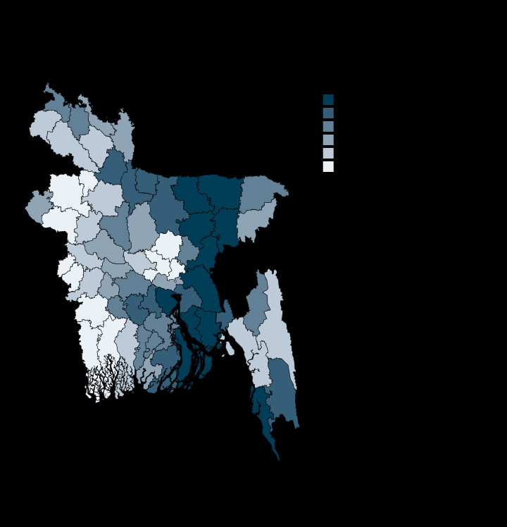
Brahmanbaria carries nearly twice Dhaka's dependency burden
Dhaka 37.1 · Brahmanbaria 72.4 · Dependants per 100
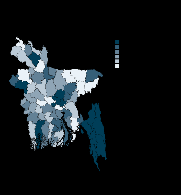
Bangladesh is a third urban, but 54 of its 64 districts sit below that
Moulvibazar 14.3 · Dhaka 74.8 · Per cent of households
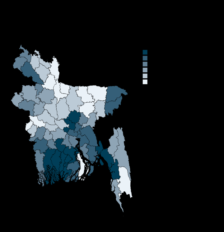
Rural Pirojpur, not Dhaka, has the country's highest literacy rate
Jamalpur 61.7 · Pirojpur 85.5 · Per cent literate
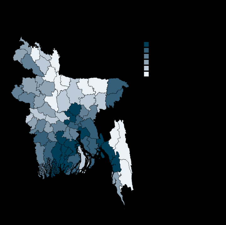
Female literacy spans 27 points, from Bandarban to Pirojpur
Bandarban 58.2 · Pirojpur 85.1 · Per cent literate
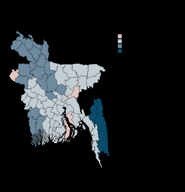
Women out-read men in only four of Bangladesh's 64 districts
Rangamati -13.2 · Chapai Nawabganj 2.2 · Percentage points
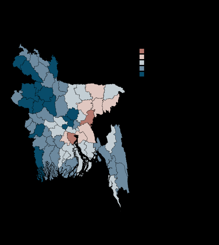
Brahmanbaria has 110 female students per 100 male, Rajshahi 82
Rajshahi 81.5 · Brahmanbaria 109.7 · Female per 100 male
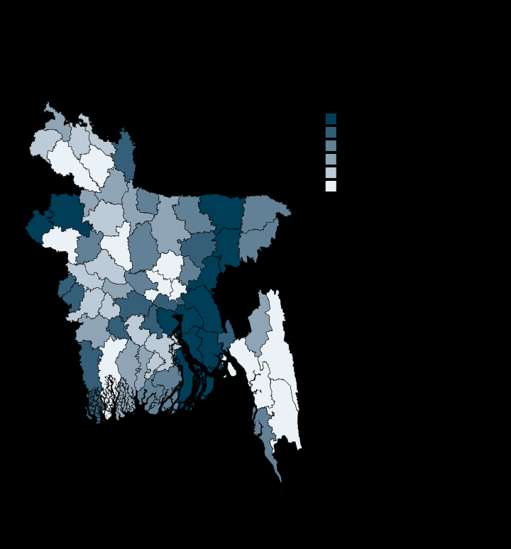
In 49 of 64 districts, more than a third of 15-24s are not in education or work
Dhaka 25.4 · Lakshmipur 42.2 · Per cent NEET
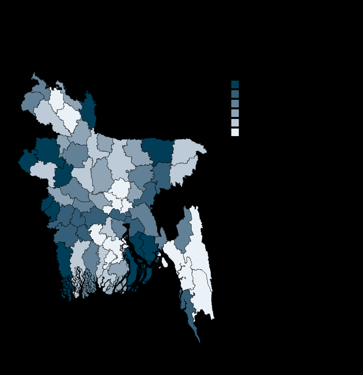
In Bhola, 61% of young women are not in education, employment or training
Gazipur 40.7 · Bhola 61.4 · Per cent NEET
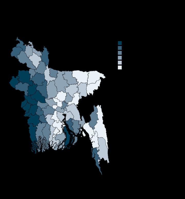
Young women's exclusion exceeds young men's in every district, by 31 to 50 points
Gazipur 31.2 · Chuadanga 50.2 · Percentage points
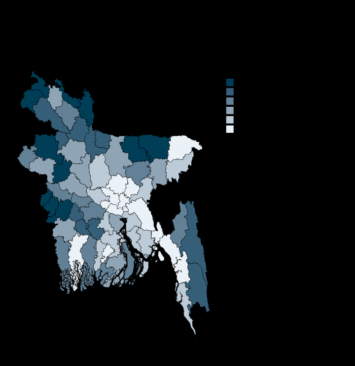
Agriculture still employs 63% of workers in Sunamganj and 5% in Dhaka
Dhaka 4.7 · Sunamganj 63.3 · Per cent of employed
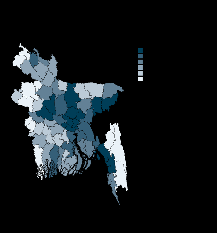
Industrial work concentrates in a narrow Gazipur-Narayanganj corridor
Rangamati 3.7 · Gazipur 61.5 · Per cent of employed
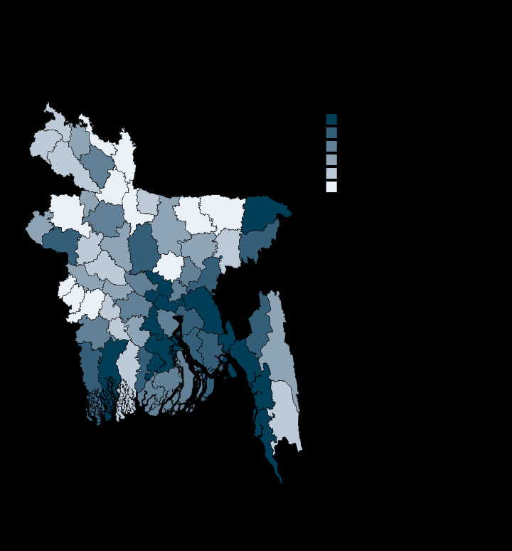
Services are the largest sector in 19 districts but pass half in only seven
Kurigram 27.6 · Dhaka 62.7 · Per cent of employed
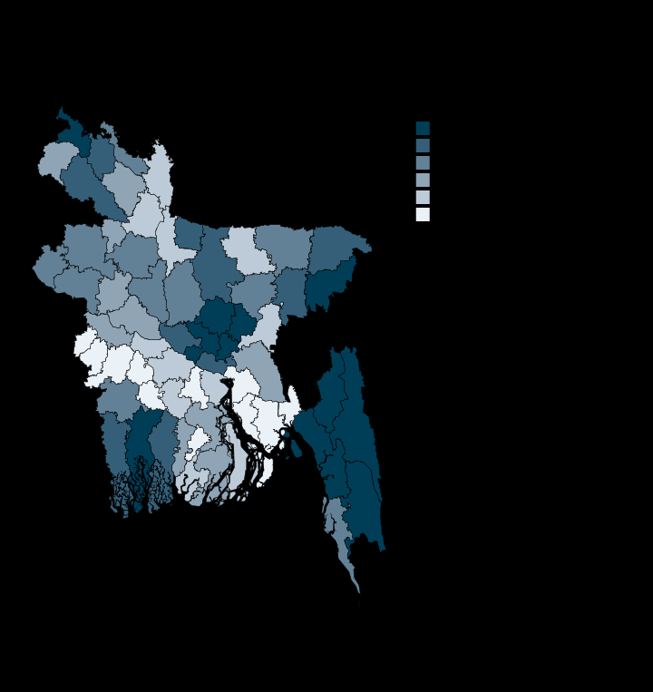
One woman in ten is employed, and in Feni one in sixteen
Feni 6.3 · Gazipur 30.0 · Per cent of women 5+
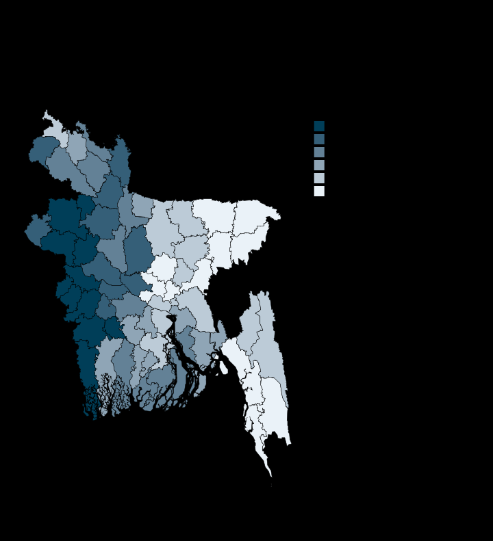
More than half of women and girls aged 5 and over do unpaid household work
Gazipur 38.3 · Meherpur 64.7 · Per cent of women 5+
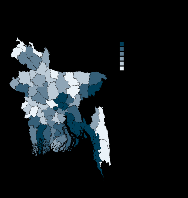
Four in five Gazipur workers draw a wage, two in five in Netrakona
Netrakona 42.6 · Gazipur 79.1 · Per cent of employed
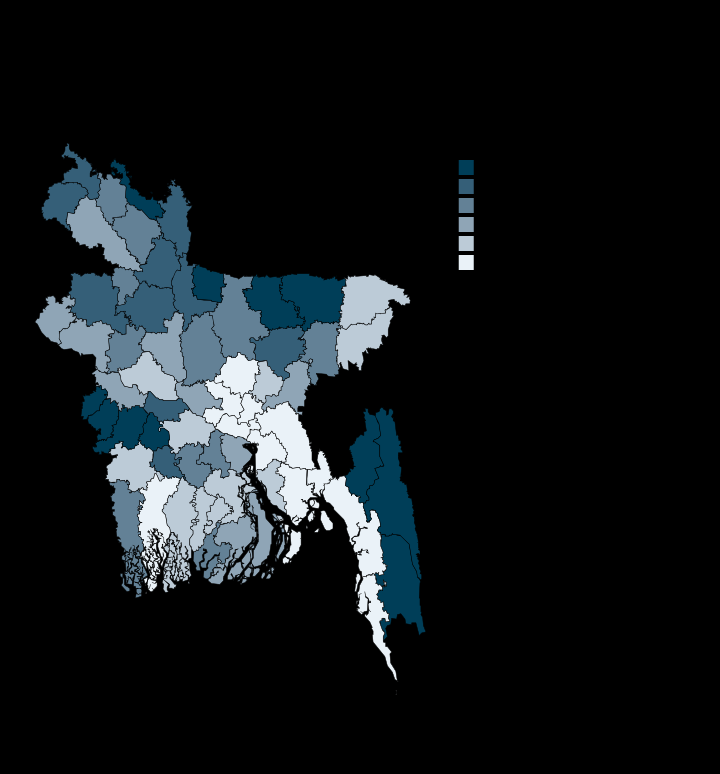
Three in ten Bandarban workers produce for their own household, not a market
Dhaka 2.1 · Bandarban 30.2 · Per cent of employed
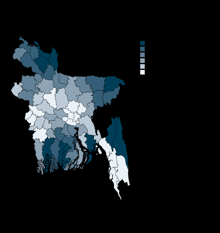
Nowhere do more than 3% of people report looking for work
Narayanganj 0.7 · Jhalokati 2.9 · Per cent of people 5+
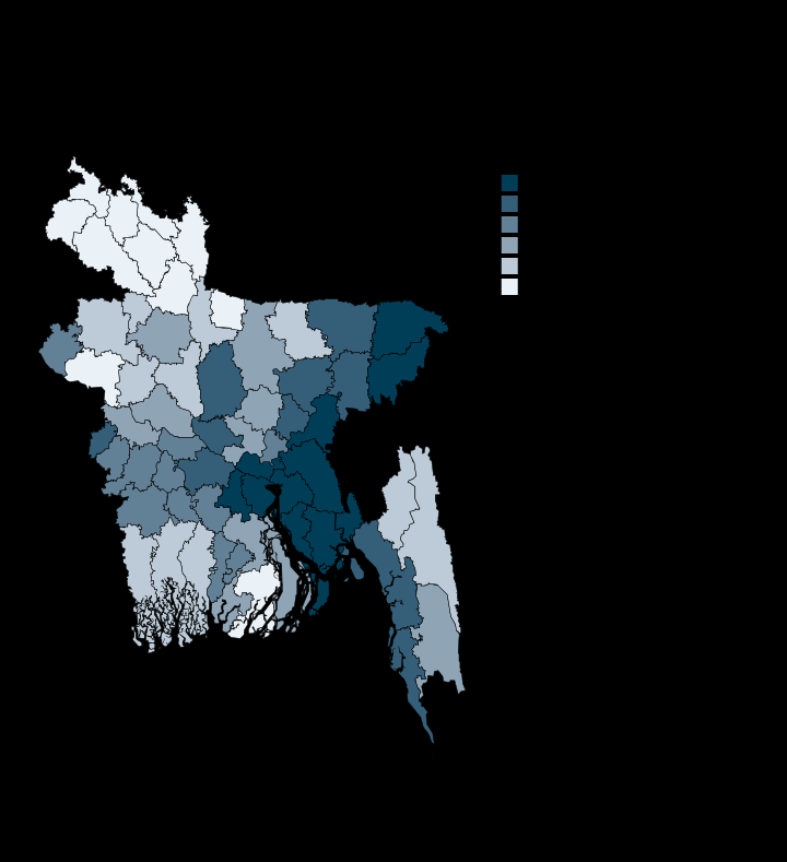
A third of Feni's households receive money from abroad, 0.7% of Lalmonirhat's
Lalmonirhat 0.7 · Feni 33.9 · Per cent of households
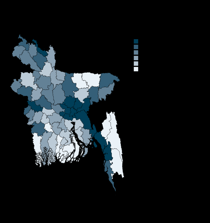
Dhaka's nights are fifteen times brighter than Rangamati's
Rangamati 0.38 · Dhaka 5.62 · Radiance
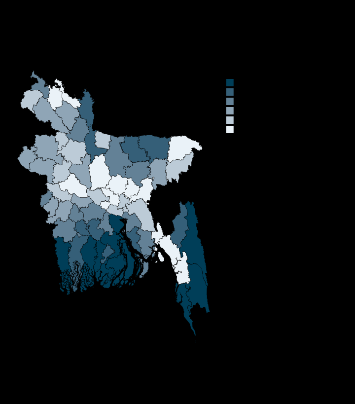
The southern coastal belt lit up fastest since 2014; Dhaka ranks 56th of 64
Brahmanbaria 48.0 · Patuakhali 416.7 · Per cent change
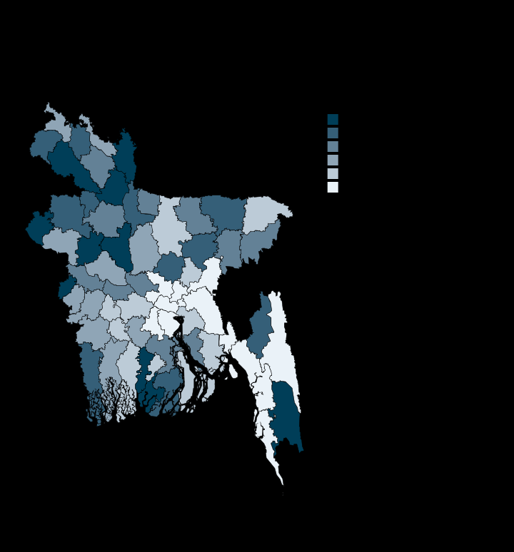
Food insecurity tracks the northern monga belt, led by Kurigram
Cumilla 3.1 · Kurigram 9.6 · INFORM score, 0 to 10
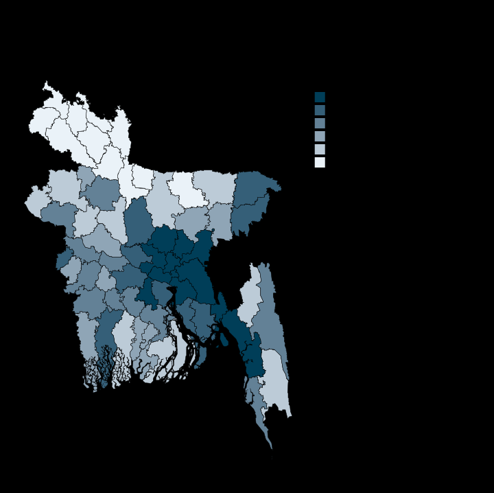
Internet use in Dhaka is three and a half times Panchagarh's
Panchagarh 15.2 · Dhaka 53.0 · Per cent using internet
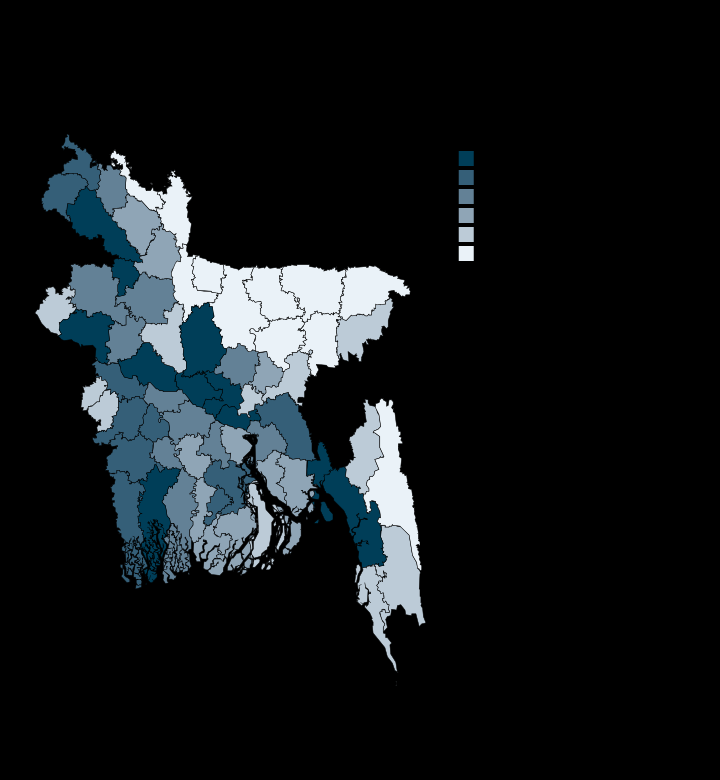
No district has half its people holding a bank account
Sunamganj 12.6 · Dhaka 34.6 · Per cent with an account
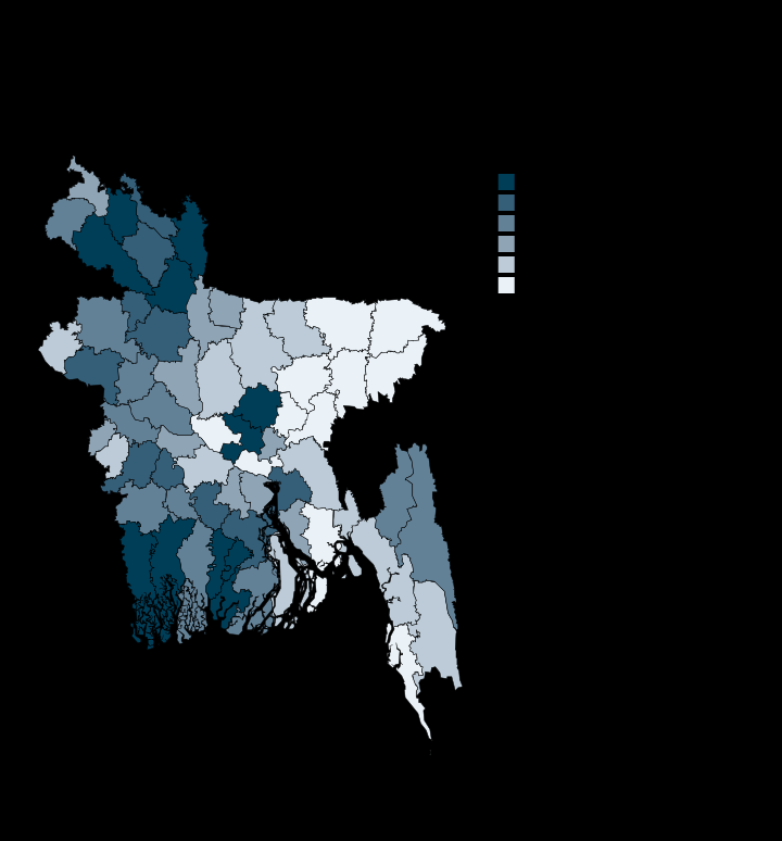
Mobile money reaches more people than banks do, in every district
Sunamganj 26.4 · Gazipur 51.4 · Per cent with an account

Mobile money's lead over banking runs from 4 points to 27
Munshiganj 3.7 · Kurigram 27.1 · Percentage points
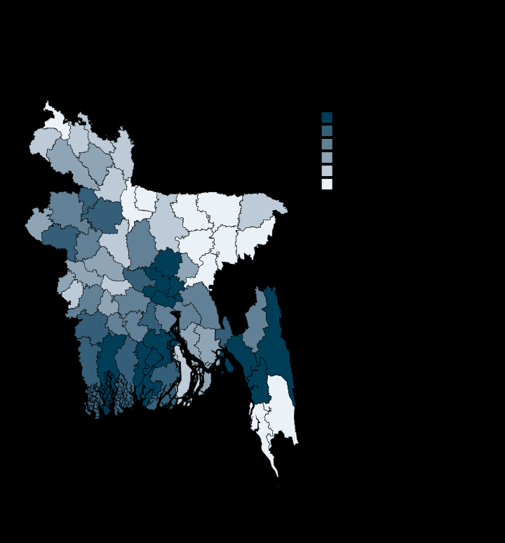
More than half of people aged 5 and over have a phone in 53 of 64 districts
Sunamganj 42.7 · Dhaka 71.2 · Per cent with a phone
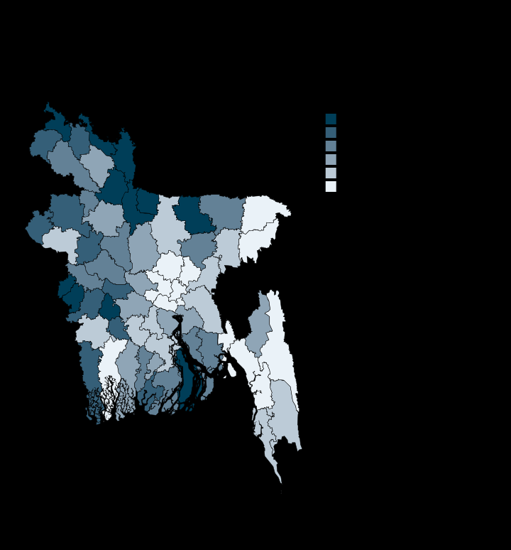
Four in five households own their home, and in Dhaka only 28%
Dhaka 27.5 · Meherpur 96.9 · Per cent of households
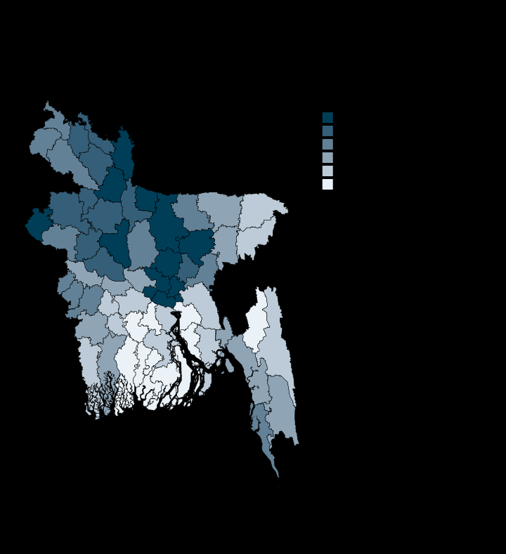
More than a quarter of households share a toilet with another household
Jhalokati 9.3 · Gazipur 44.6 · Per cent of households
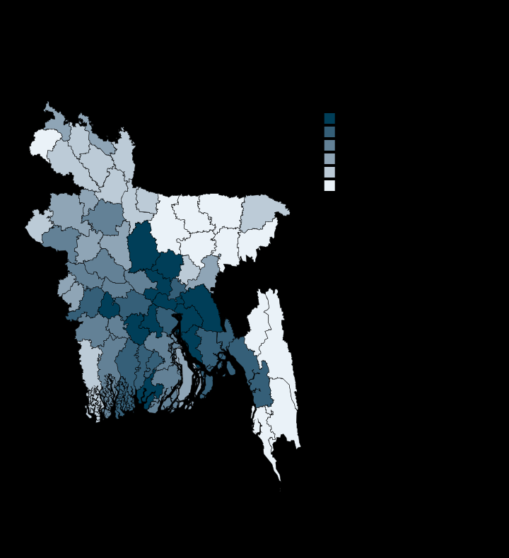
Improved sanitation reaches 43% of Bandarban and 92% of Magura
Bandarban 42.8 · Magura 91.7 · Per cent of households
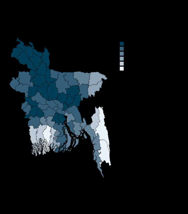
Ten districts fall below 95% on tap or tube-well water, led by Bagerhat at 57%
Bagerhat 56.8 · Natore 100.0 · Per cent of households
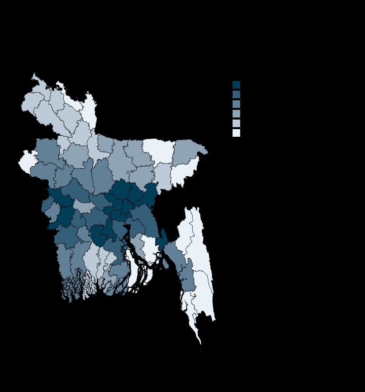
Electricity reaches 97% of general households in 59 of 64 districts
Bandarban 88.2 · Narayanganj 99.8 · Per cent of households
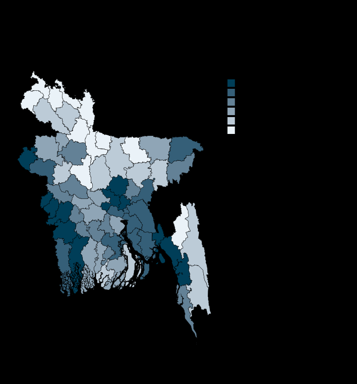
One house in fifty is brick-built in Kurigram, two in three in Dhaka
Kurigram 2.1 · Dhaka 67.8 · Per cent of households
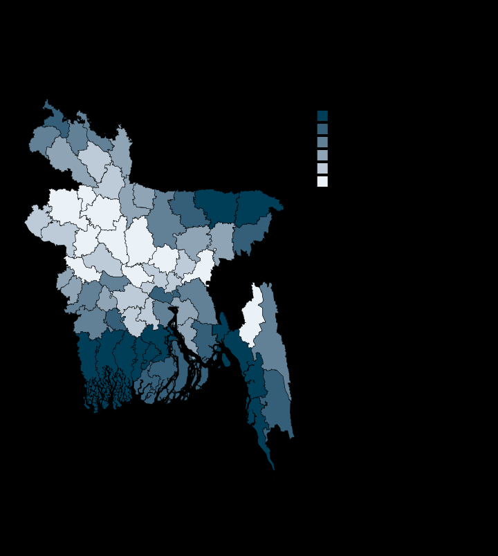
The 12 districts with the most shanty housing are all delta or wetland
Bogura 0.07 · Cox's Bazar 7.99 · Per cent of households
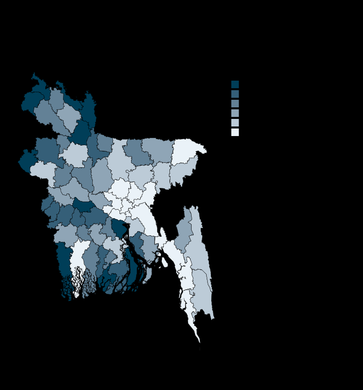
Three in four households still cook on wood, dung or crop residue
Dhaka 13.0 · Kurigram 96.3 · Per cent of households
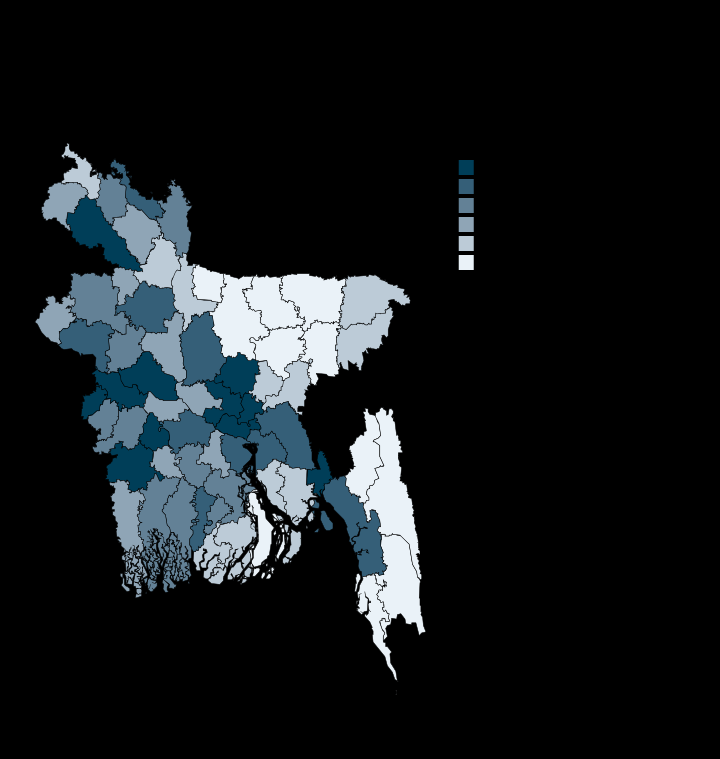
A third of Bandarban's households have soap and water at hand, nine in ten of Dhaka's
Bandarban 34.9 · Dhaka 89.0 · Per cent of households
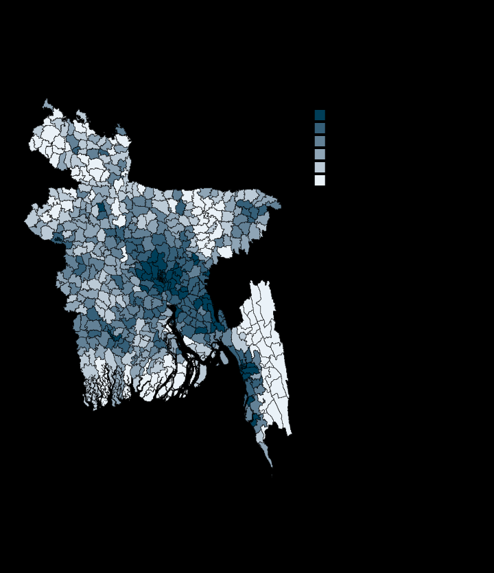
Nine of the ten poorest upazilas are in the Chittagong Hill Tracts
Belai Chhari -0.54 · Shyampur 2.0 · Relative Wealth Index
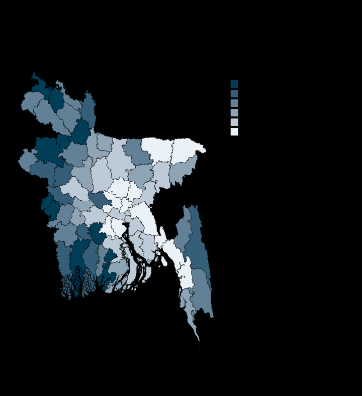
Reported disability is three times higher in Jhalokati than in Dhaka
Dhaka 0.73 · Jhalokati 2.33 · Per cent of people
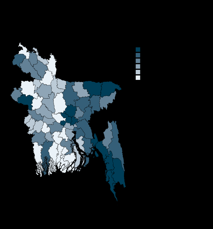
Epidemic risk is highest where people are densest and most mobile
Pirojpur 4.3 · Dhaka 8.9 · INFORM score, 0 to 10
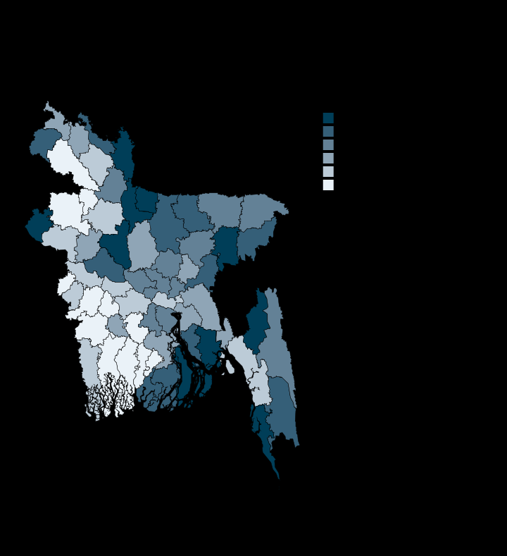
Health services are thinnest in Sherpur and Cox's Bazar, best reached in Gopalganj
Gopalganj 3.2 · Sherpur 7.9 · INFORM score, higher is worse
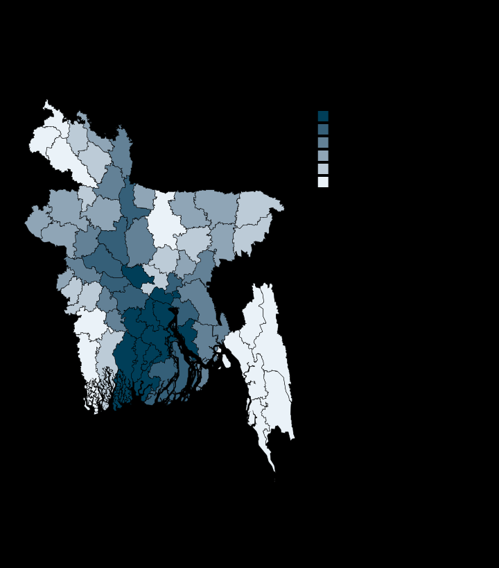
Nearly three in five Bangladeshis live in the 100-year floodplain
Thakurgaon 3.1 · Jhalokati 98.3 · Per cent of population
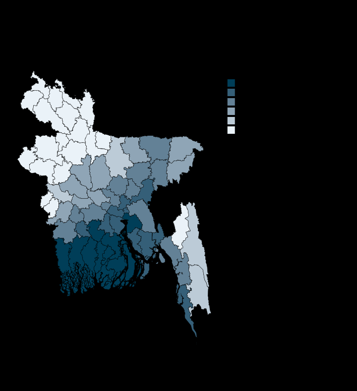
99.5% of Jhalokati's people live below five metres; in Bogura, none do
Bogura 0.0 · Jhalokati 99.5 · Per cent of population
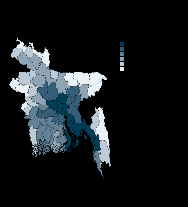
Every district breathes air at 8 to 17 times the WHO guideline
Sylhet 42.1 · Noakhali 85.3 · ug/m3, pop-weighted
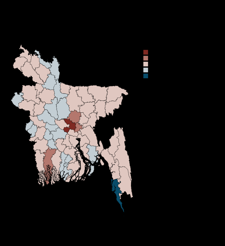
Dhaka's people live 2.1C hotter than its average land surface
Cox's Bazar -2.9 · Dhaka 2.1 · Degrees Celsius
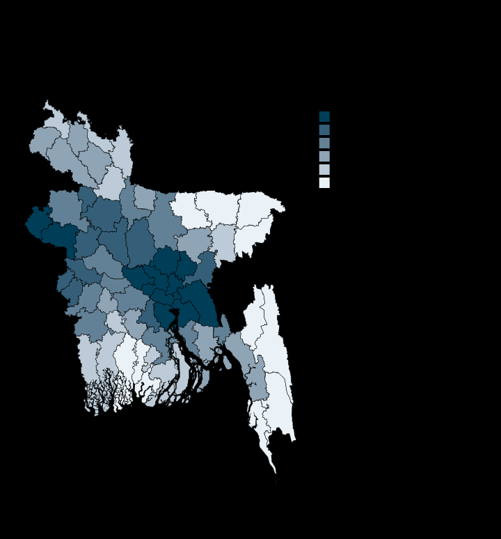
Nitrogen dioxide peaks over the Dhaka-Narayanganj industrial belt
Bandarban 17.9 · Narayanganj 143.1 · umol/m2
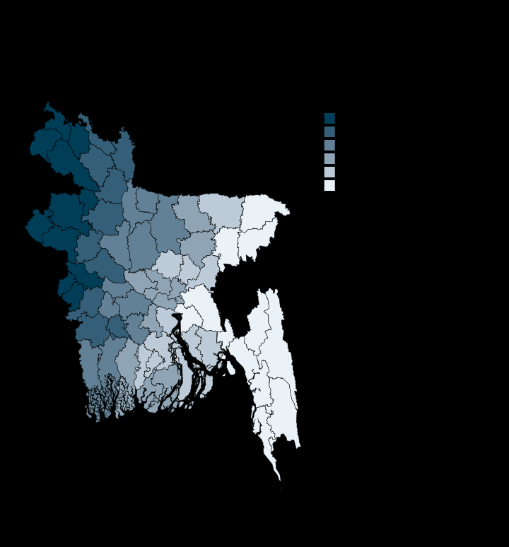
Aerosol loading is worst across the north-western border districts
Bandarban 0.313 · Thakurgaon 0.781 · AOD 550 nm
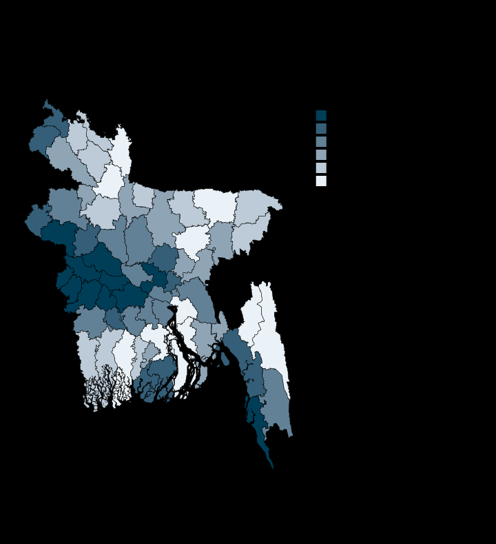
The hottest land surface runs along the western border, with Cox's Bazar the exception
Sunamganj 25.6 · Meherpur 28.1 · Degrees Celsius
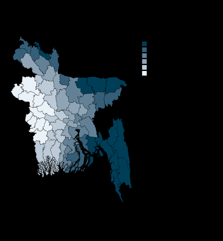
Sunamganj gets nearly three times Chapai Nawabganj's rain
Chapai Nawabganj 1495.0 · Sunamganj 4233.0 · Millimetres a year
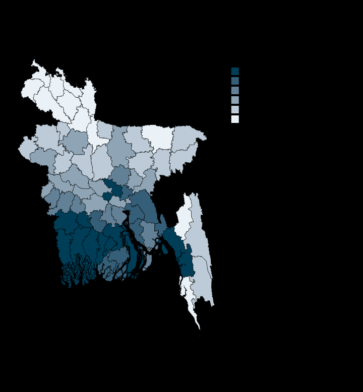
Dhaka's nights run 3.6C warmer than Panchagarh's
Panchagarh 21.4 · Dhaka 25.0 · Degrees Celsius
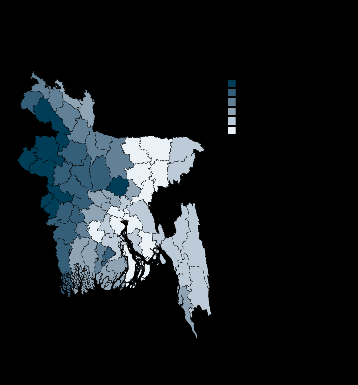
Drought risk concentrates in the north-west Barind, not the dry season generally
Gopalganj 0.6 · Chapai Nawabganj 10.0 · INFORM score, 0 to 10
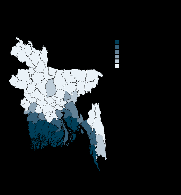
Cyclone risk stops at the coast: 40 of 64 districts score zero
Khagrachhari 0.0 · Satkhira 9.9 · INFORM score, 0 to 10
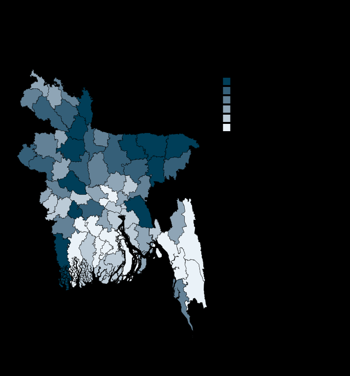
Lightning risk peaks in the haor, where people work open ground in the monsoon
Bhola 0.0 · Habiganj 10.0 · INFORM score, 0 to 10
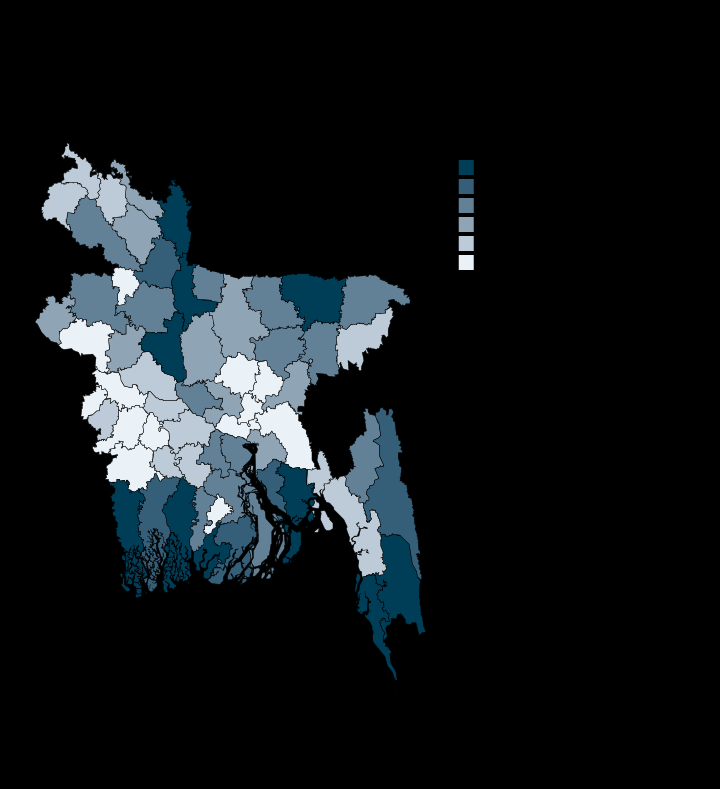
Bandarban and Cox's Bazar carry the highest overall risk, Narayanganj the lowest
Narayanganj 4.4 · Bandarban 6.3 · INFORM score, 0 to 10
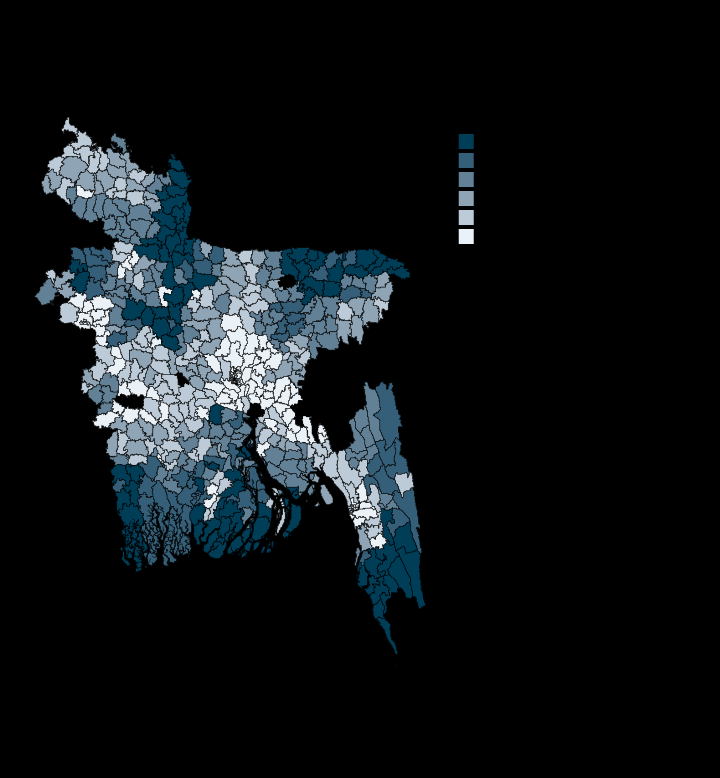
Five of the six highest-risk upazilas are in Bandarban
Meghna 4.5 · Raumari 6.5 · INFORM score, 0 to 10
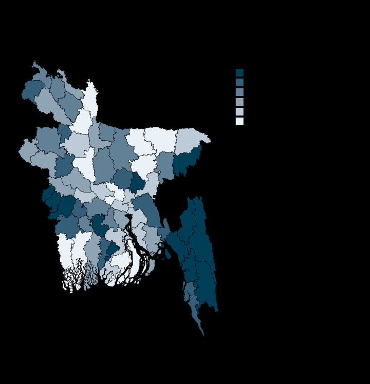
The Hill Tracts stay green while the haor basin runs bare
Sunamganj 0.379 · Bandarban 0.734 · NDVI
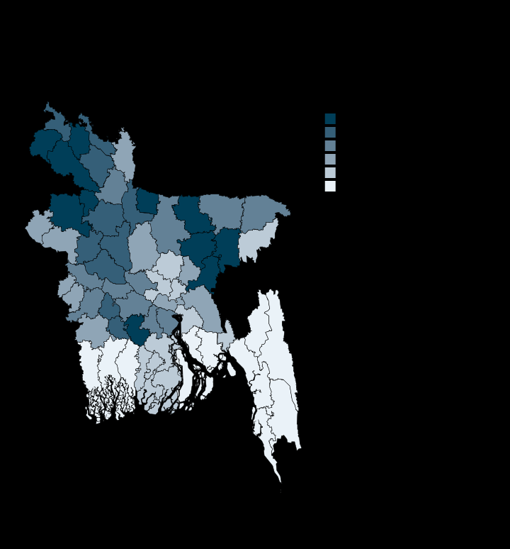
Nearly half the country is cropland, and three-quarters of Naogaon
Bandarban 1.7 · Naogaon 74.5 · Per cent of land area
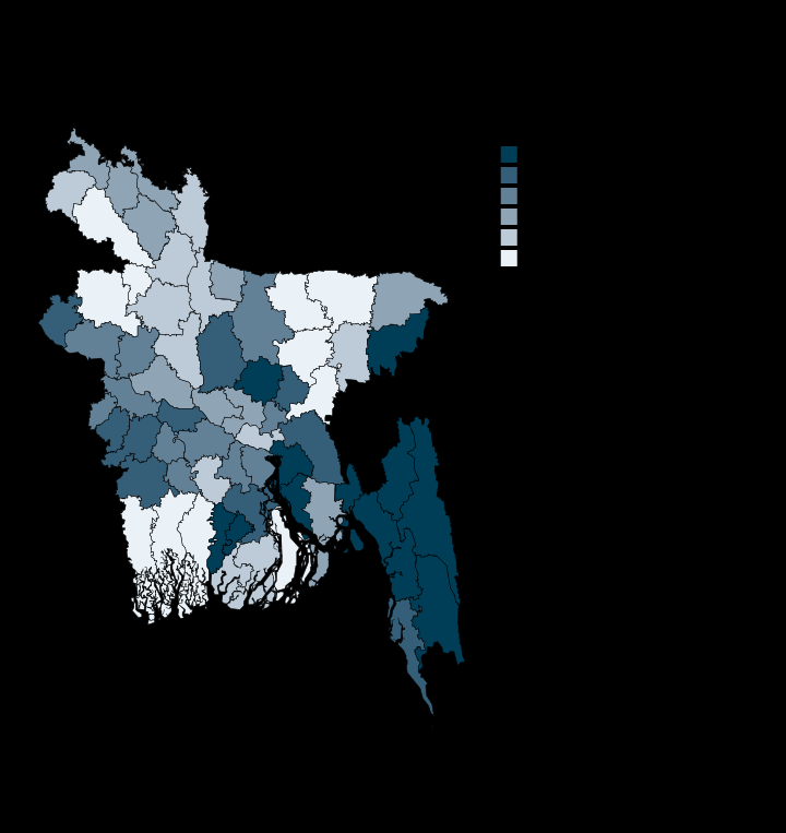
Bandarban is 97% tree cover, Khulna 11%
Khulna 10.7 · Bandarban 96.6 · Per cent of land area
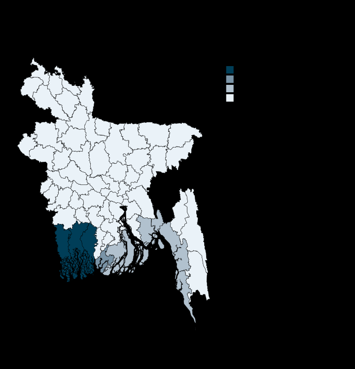
Three districts hold 98% of Bangladesh's mangroves
Barishal 0.0 · Bagerhat 37.88 · Per cent of land area
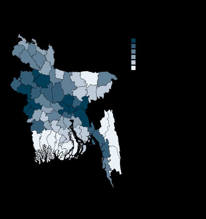
Even Dhaka district is under a tenth built-up
Bandarban 0.2 · Dhaka 9.6 · Per cent of land area
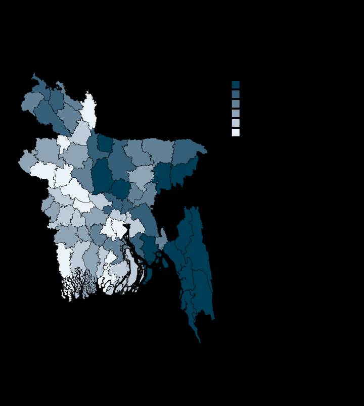
Bandarban has lost tree cover across 27% of its land since 2001
Shariatpur 0.01 · Bandarban 27.01 · Per cent of land area
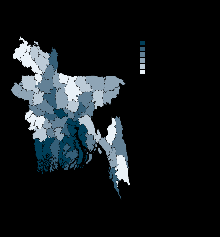
Permanent water covers 19% of Bhola and 3% of the country
Mymensingh 0.0 · Bhola 18.6 · Per cent of land area
Every plate names its own source on the figure. Most census plates come from the Bangladesh Bureau of Statistics, Population and Housing Census 2022, published by the UN in Bangladesh; the rest are satellite records aggregated in-repo, the INFORM Subnational Risk Index 2022, and the Meta Relative Wealth Index. Boundaries do not carry official status. Maps use the current BBS district names; the boundary file still carries several pre-rename spellings.