← Atlas
AIR
 SOURCE
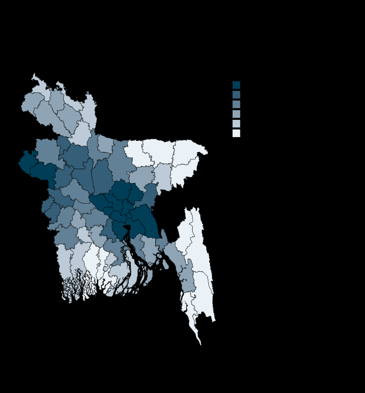
Nitrogen dioxide peaks over the Dhaka-Narayanganj industrial belt
143.1
Highest · Narayanganj
17.9
Lowest · Bandarban
64/64
Districts with a value
umol/m2
Unit
Derived in-repo from Google Earth Engine district aggregations; Sentinel-5P TROPOMI tropospheric NO2
Each plate is a standalone SVG, drawn at publication scale. Open the file.
MORE IN CLIMATE AND EXPOSURE