← Atlas
HEAT
 SOURCE
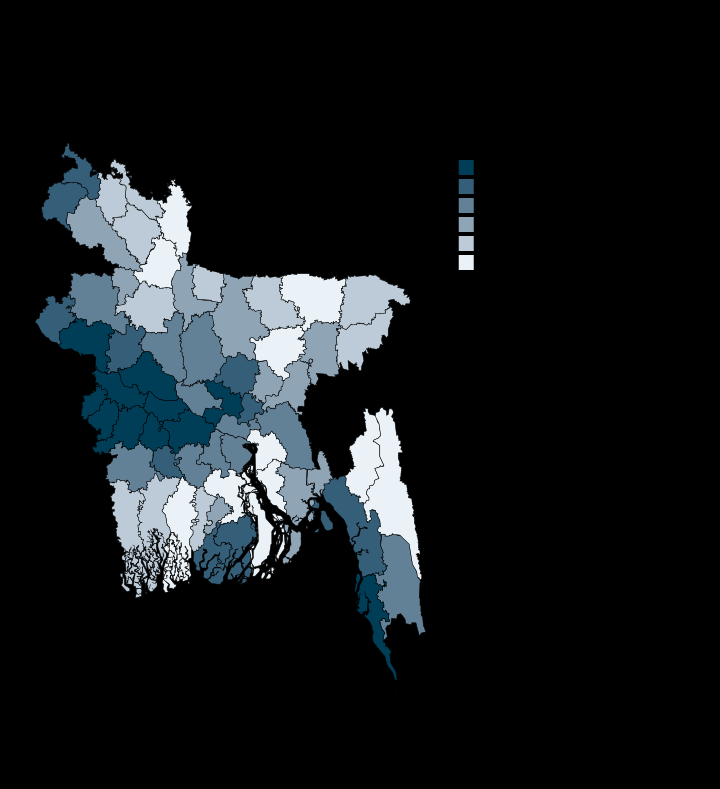
The hottest land surface runs along the western border, with Cox's Bazar the exception
28.1
Highest · Meherpur
25.6
Lowest · Sunamganj
64/64
Districts with a value
Degrees Celsius
Unit
Derived in-repo from Google Earth Engine district aggregations; MODIS MOD11A2 8-day LST_Day_1km, simple annual mean with no QA mask applied
Each plate is a standalone SVG, drawn at publication scale. Open the file.
MORE IN CLIMATE AND EXPOSURE