Next steps
Atlas · Living standards
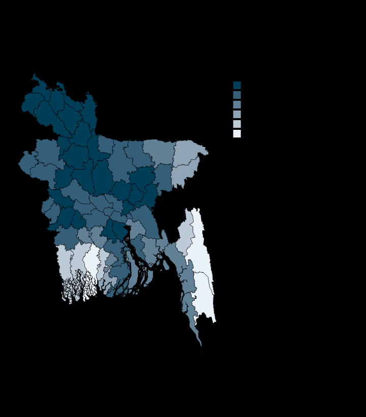
Highest district
Natore
100 Per cent of households
Lowest district
Bagerhat
56.8 Per cent of households
Coverage
64 of 64 districts carry a value.
Unit
Per cent of households
Reading this plate
Tap and tube-well only. This is NOT the WHO/UNICEF JMP improved-source definition, which also counts rainwater, packaged water and protected wells, all of which BBS reports separately. The unweighted district mean is 96% and 44 districts are above 99%, so the classes are stated rather than equal-count: this is a map to read at its tail. Bagerhat 56.8%, Rangamati 60.3% and Bandarban 67.8% are the extremes, and on the south-west coast salinity rather than absent infrastructure is the constraint.
Source
Bangladesh Bureau of Statistics, Population and Housing Census 2022, via UN in Bangladesh (HDX)
Source: Bangladesh Bureau of Statistics, Population and Housing Census 2022, via UN in Bangladesh (HDX)