Executive finding
One built-up ridge from Old Dhaka to Gazipur, and an urban share that reaches only 37 percent by 2036 on the last decade's pace.
Bangladesh 2036, chapter 8 of 10. Contents, sources and the five numbers.
Dhaka is a country inside a country
The urban transition is happening and it is happening in one place.
The urban share reached 33.24 percent in 2025 from 27.73 percent in 2010, and the urban population reached 58.40 million. Urban growth ran 2.92 percent in 2025, the fastest since 2006. The rural population is still rising: 110.91 million in 2012 and 117.29 million in 2025. Bangladesh is urbanising without depopulating its villages, which is why land keeps leaving cultivation while rural labour supply does not fall.
Dhaka absorbs the transition. The agglomeration grew from 14.73 million in 2010 to 24.65 million in 2025 and its share of the national urban population rose every single year, from 34.91 percent to 42.22 percent. Cities above one million people hold 30.31 million people, 17.25 percent of the national population, up from 12.38 percent in 2010. Dhaka district holds 14.73 million people at 10,067 per square kilometre with a 76.3 percent urban share, Gazipur district 5.26 million growing at 10.51 percent a year in its urban areas, and Narayanganj 3.91 million at 5,712 per square kilometre.
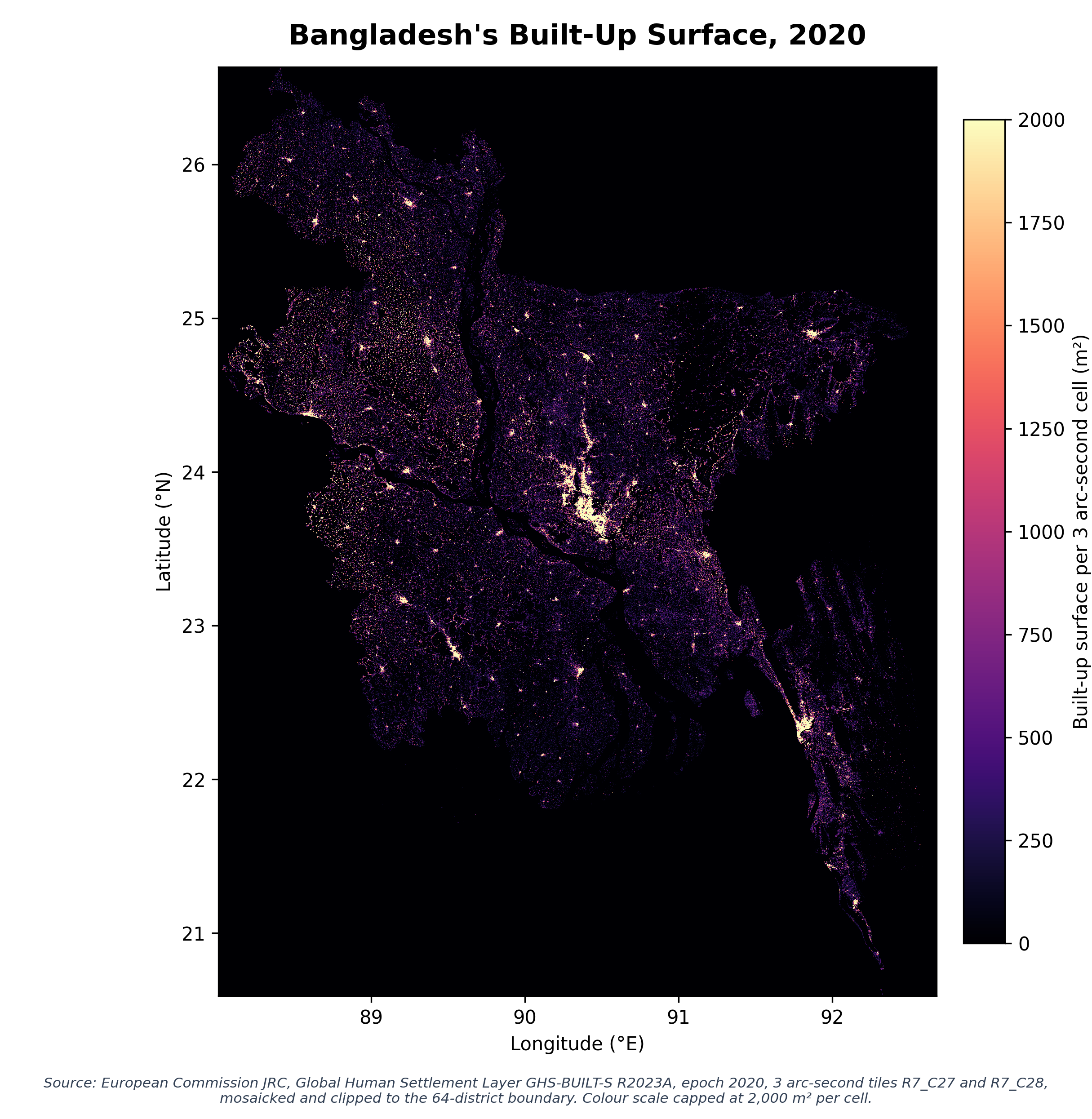
Built up expansion is a Dhaka, Gazipur and Narayanganj corridor phenomenon, and the corridor is the same one that holds the garment industry, the port road and the flood flow zones the detailed area plan was meant to protect.
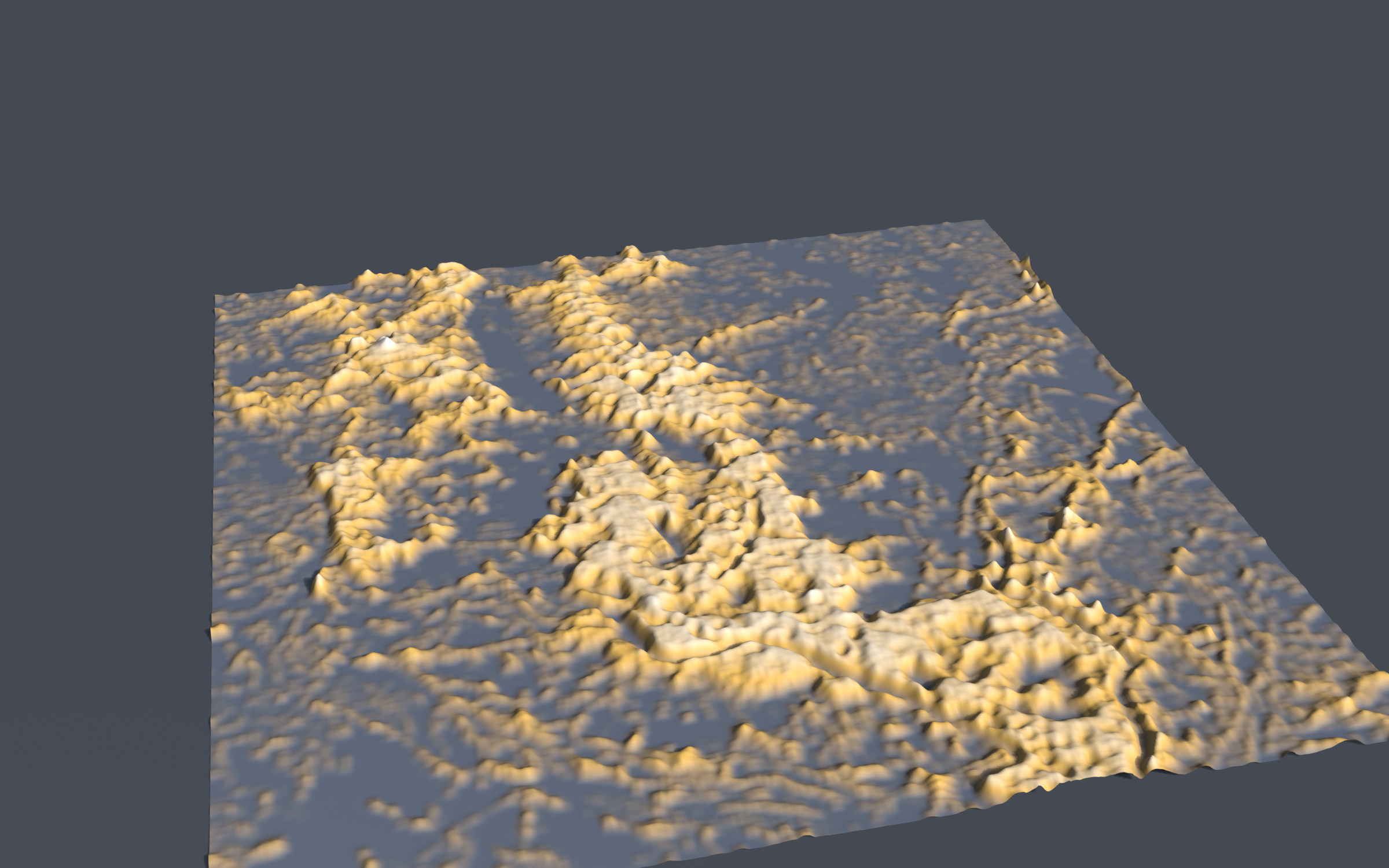
Dhaka's built surface is now dense enough that the binding constraint on its growth is vertical infrastructure and drainage, not land at the edge.
The rest of the country is emptying unevenly. Twenty five of 64 districts recorded negative rural population growth between 2011 and 2022. Rangpur district lost rural population at 1.17 percent a year while its urban population grew 7.52 percent. Non Dhaka districts averaged 4.4 percent annual urban growth. Divisional upper poverty in 2022 ran from 14.8 percent in Khulna to 26.9 percent in Barishal, with Mymensingh at 24.2 and Rangpur at 24.8, a spread of 12.1 points. Rangpur's own fall from 47.2 percent in 2016 is the largest in the table and it is still among the poorest.
Housing has not kept up. Census 2022 records 58.78 percent of dwellings as kancha, 22.46 percent pucca and 18.18 percent semi pucca, with 80.79 percent owner occupied. The slum population is 1.74 million on the census count, 5.13 percent of households in Dhaka and 3.80 percent in Chattogram against 1.20 percent nationally, while UN-Habitat puts 51.51 percent of the urban population in slum conditions in 2022. Urban inequality is now the national headline: the urban Gini rose from 0.452 in 2010 to 0.539 in 2022 while the national Gini rose from 0.458 to 0.499.
On the 2025 pace the urban population reaches about 80 million by 2036 and on a decay to the UN growth path about 71 million, so the country has to house between 12 and 22 million additional urban residents in eleven years.
Land is the binding physical constraint. Agricultural land is 72.31 percent of the country and arable land is 0.046 hectares per person. Net cropped area fell from 19,973 thousand acres in FY19 to 19,875 in FY22 while cropping intensity reached 198 percent. Cereal production was 66.35 million tonnes in 2024 on 12.27 million hectares. Holding yields and per head consumption, the 2036 population needs about 75.2 million tonnes, 13.4 percent more, from a land base that is shrinking.
Previous: The delta is not waiting for the policy cycle
Next: The institutions weakened, and so did the numbers that measure them
Bangladesh 2036, the series. Contents and the five numbers · 1 · 2 · 3 · 4 · 5 · 6 · 7 · 8 · 9 · 10
Sources for every figure in this chapter are listed on the contents page and in the series source ledger.
Cite / Reproduce
BDPolicyLab Research. (2026). Dhaka is a country inside a country. Bangladesh Policy Laboratory. https://bdpolicylab.com/publications/dhaka-is-a-country-inside-a-country
Method and source
Source: Primary sources cited at point of use in the publicationAs of 6 Sep 2026